This is a flashback post to my holidays in Verdiago last July. For people unfamiliar with this blog, Verdiago is a tiny village I discovered in 2020, when Spain was just coming out of the first wave of Covid-19 and one of the harshest confinement in Europe. We would not be allowed to come back to the office until the following autumn, and the prospect of working from my 30 sqm flat with the 45°C heat outside was freaking me out more than the possibility of contracting Covid (which I eventually did, once we came back to the office). I also figured that renting a flat in cooler regions of Spain may be a cheaper option than the electricity bill I’d face if I spent the summer in Madrid with the aircon on. Therefore, in the summer of 2020, I packed up and moved to a remote northern village called Vergiago (this post and the following few). In the summer of 2021 home office unfortunately wasn’t an option anymore, so I went back for a short holiday. This article is an excuse to publish photographs from a couple of hikes I omitted in the previous cycling post.

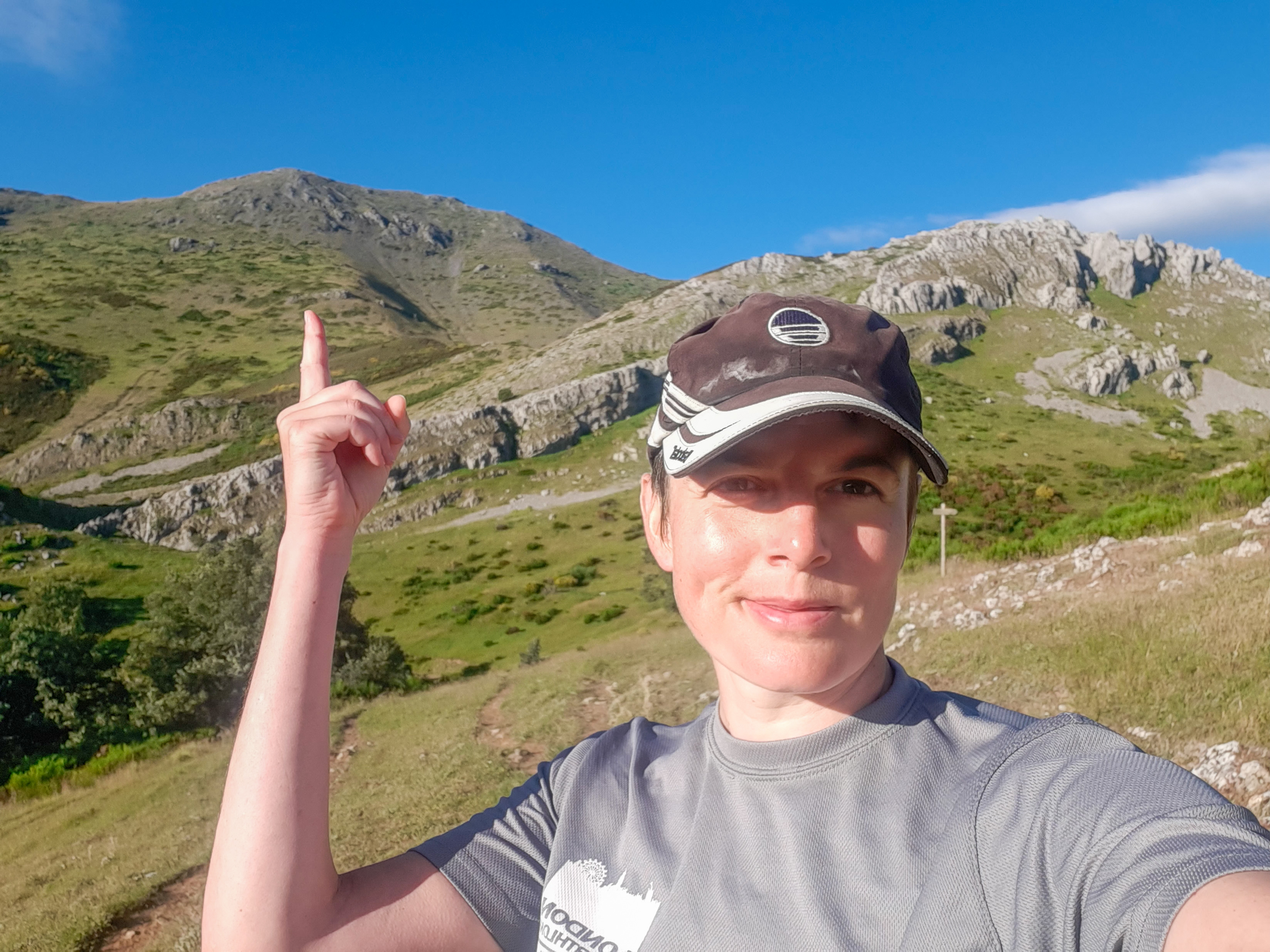
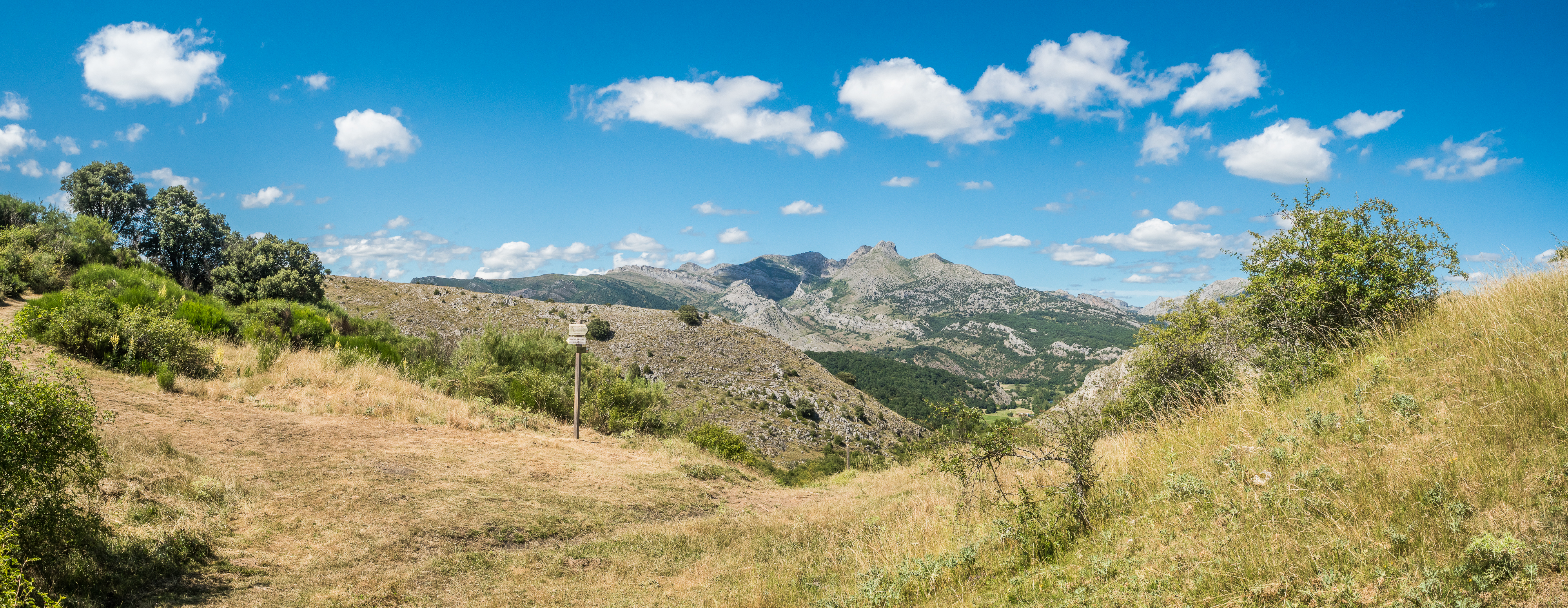
Peñacorada (1.831 m) from Fuentes de Peñacorada, circular: The peak of Peñacorada is not the most difficult, remote, or spectacular of the region. But I decided I would go hiking rather late in the day and I was looking for something reasonable. I followed this description on Wikiloc and I was wrong to trust it, especially the bit where the author claims it’s an easy hike. The more popular – and probably easier and better marked – trail starts in Cistierna, but I wanted a circular trail.
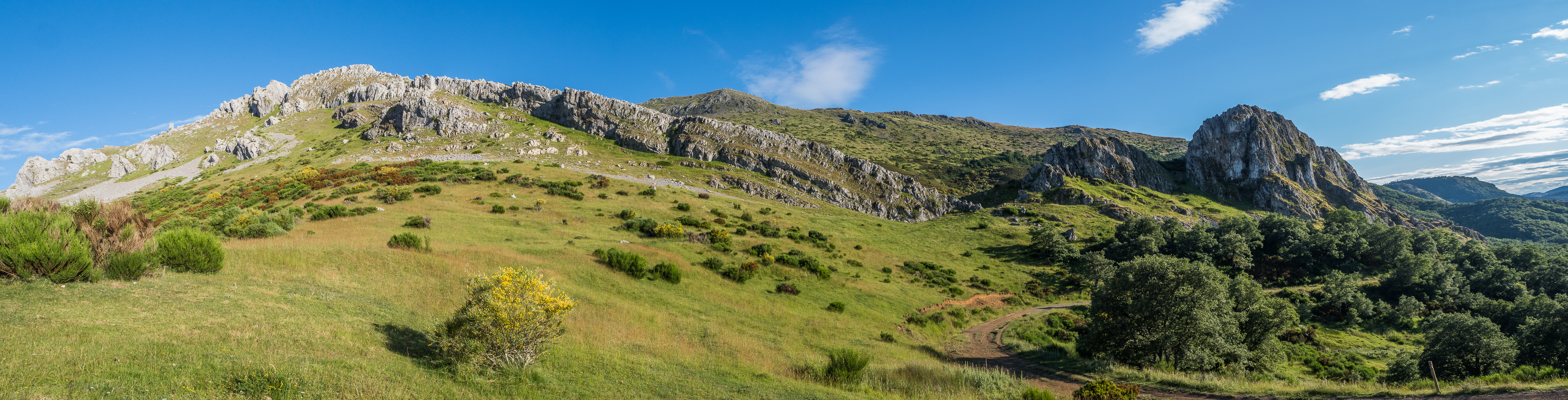
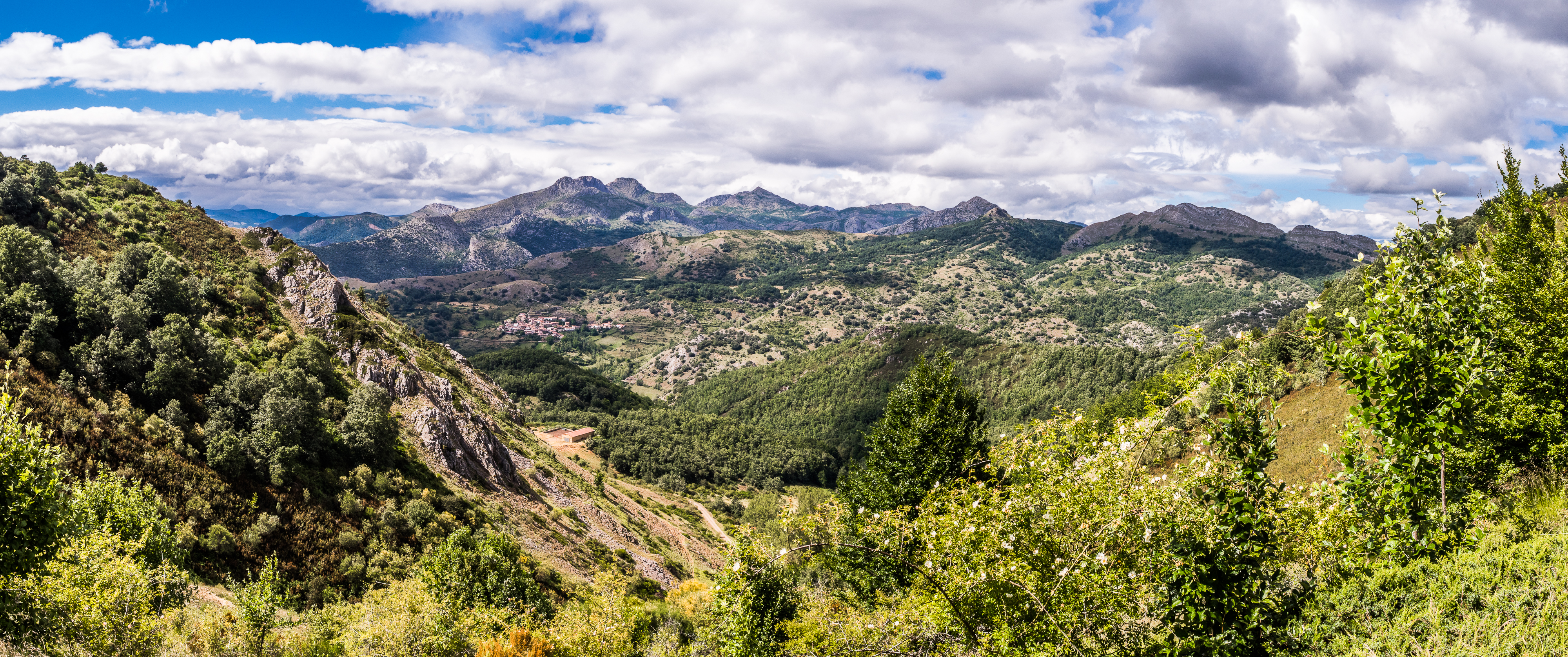
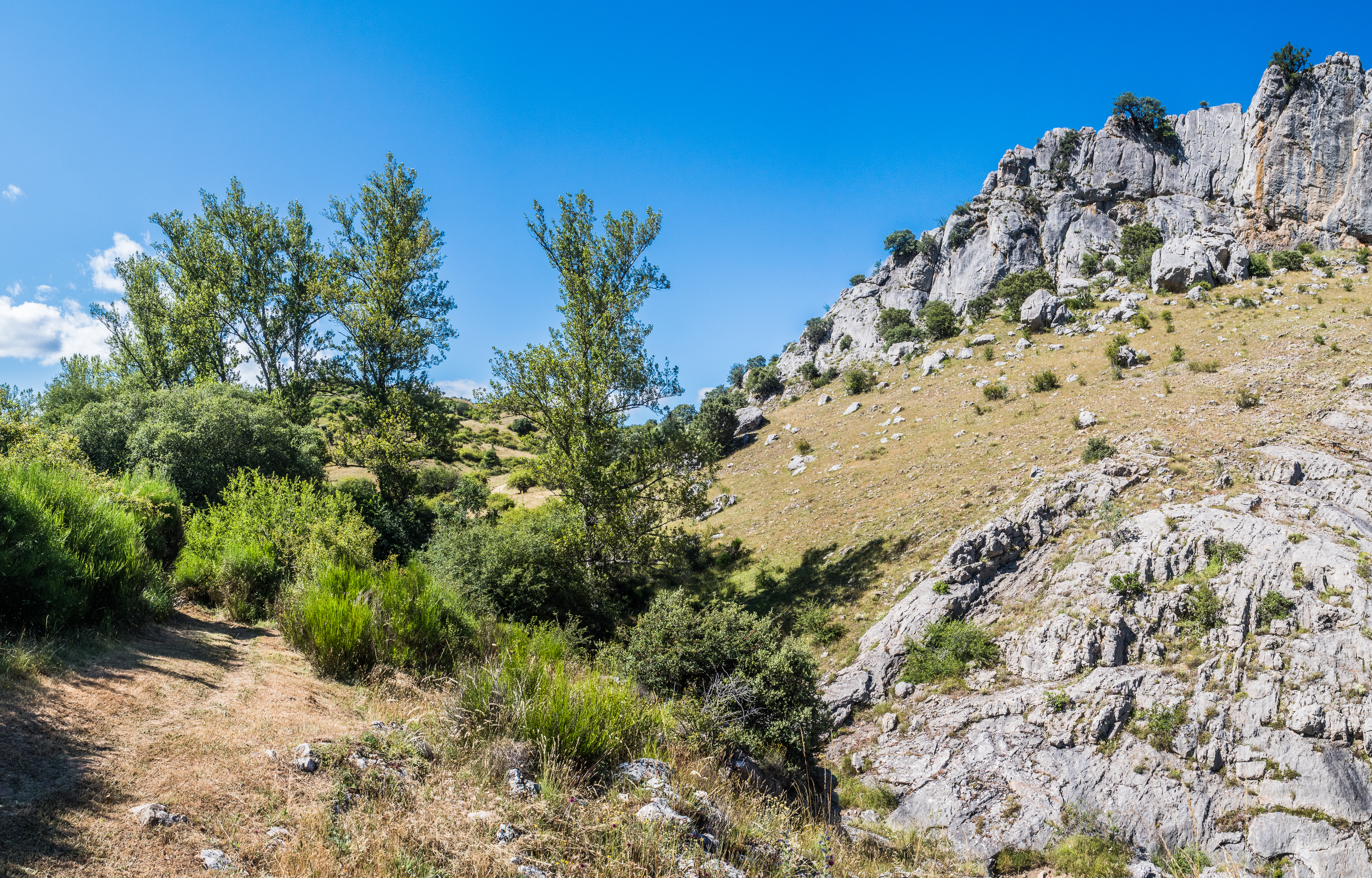
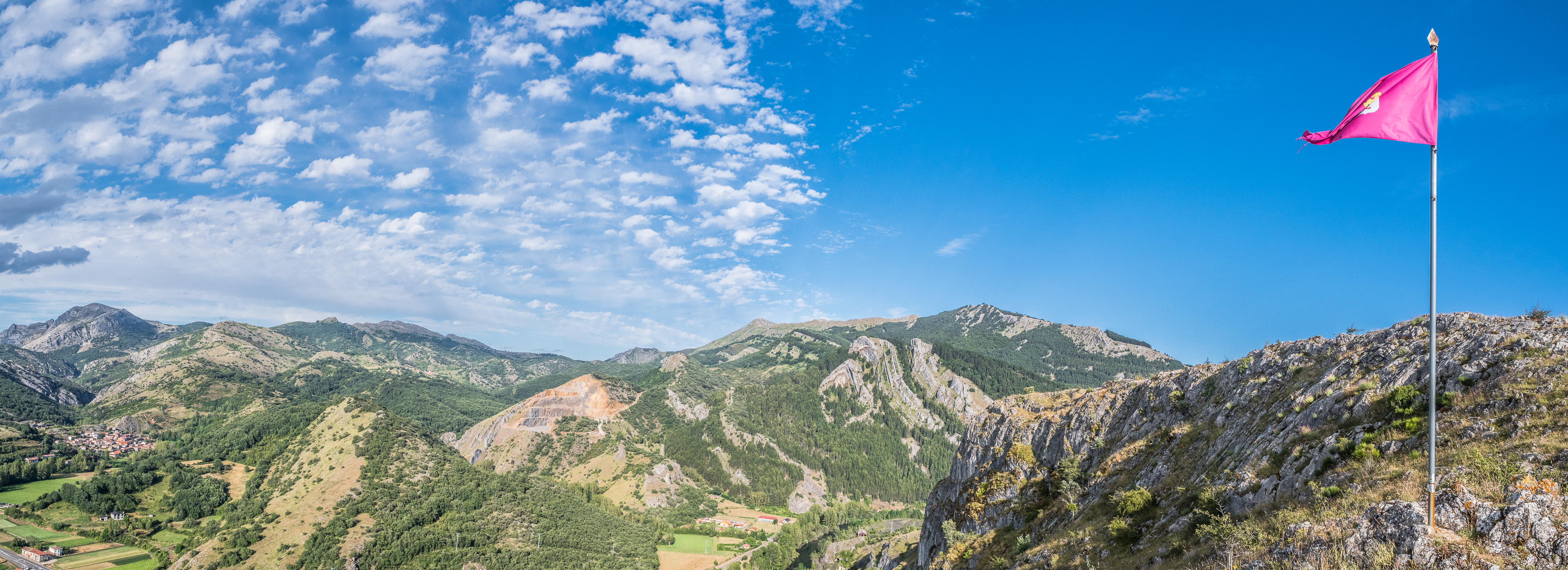
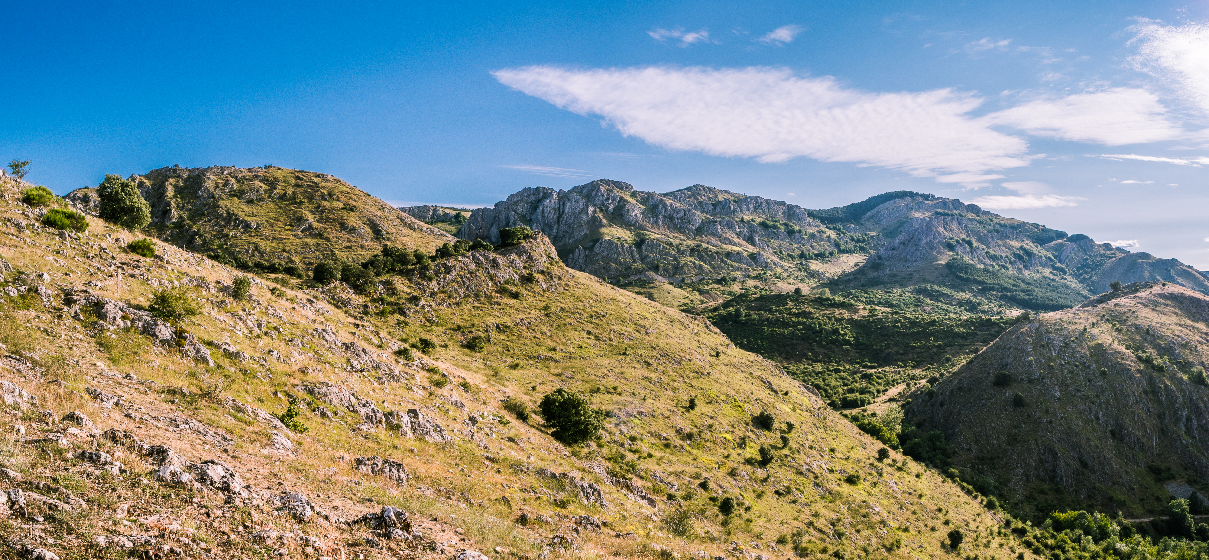
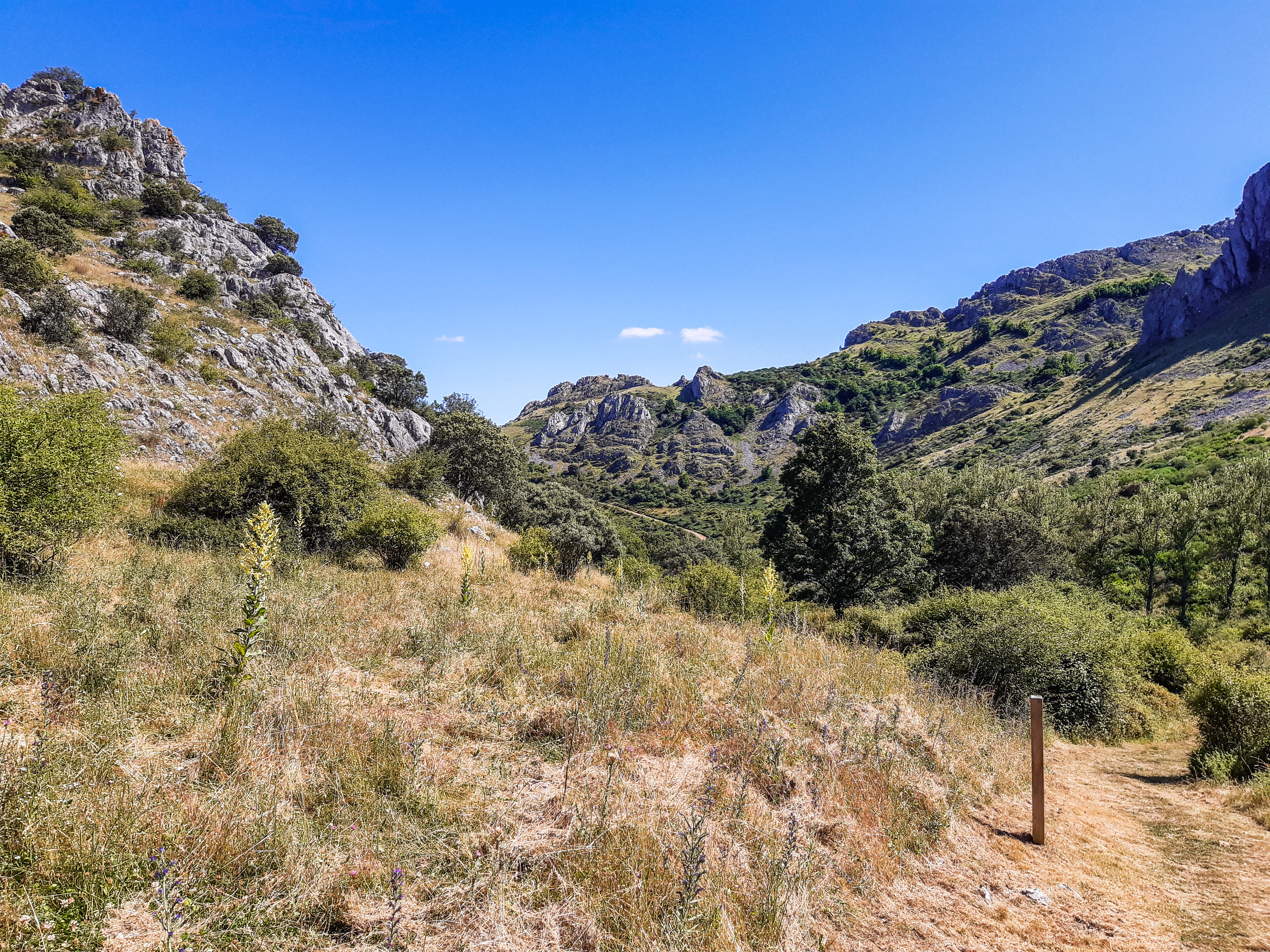
There is a signpost marked “Circular de Peñacorada” by the bus stop at the beginning of the village of Fuentes de Peñacorada. It will lead you on a wide dirt road, which you will follow for about 3 km, until you come to a point where the trail divides. You will see a couple of cattle sheds on your left hand side and take the trail that leads left and follow it for another couple hundred metres, until it crosses the stream Arroyo de Bodeguinas. Until this point, the description in the above-mentioned article is correct. After, the author was either under the influence of some dodgy mushrooms, or he’s one of those weirdos who think that trail running is a sport (and not a particularly elaborate way to commit suicide), or he’s deliberately lying. Here you leave the dirt road to start climbing along the creek upstream, the idea is to reach the ridge. Apparently, there is a “clearly marked trail” that leads you through the oak forest all the way to the crest. Trust me, there is none. And the climb is steep and rather exhausting. Once you leave the treeline, you will see the peak of Peñacorada in front of you, so at least you will have not have any problem to maintain the direction. Eventually, you will encounter a trail marked with yellow signs (the one from Cistierna), after which the gradient levels up and follows the ridge until the final ascend to the peak.
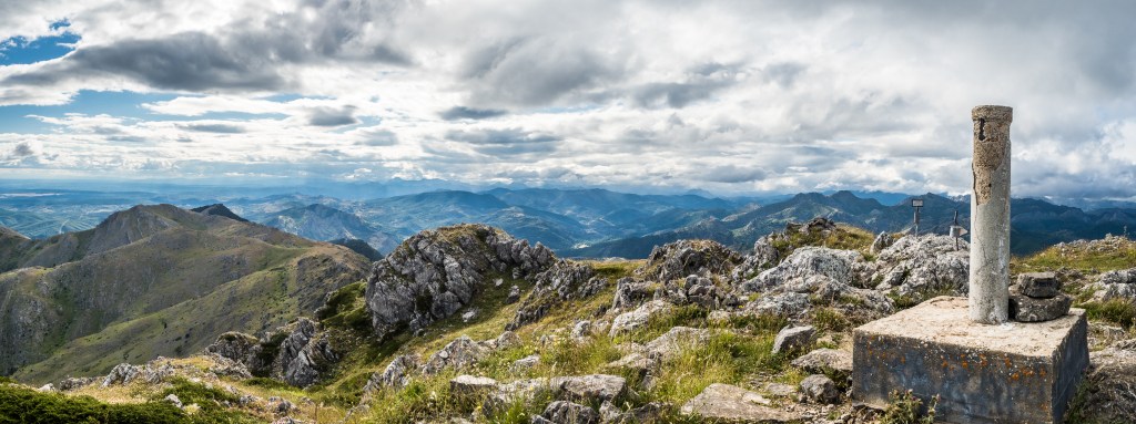
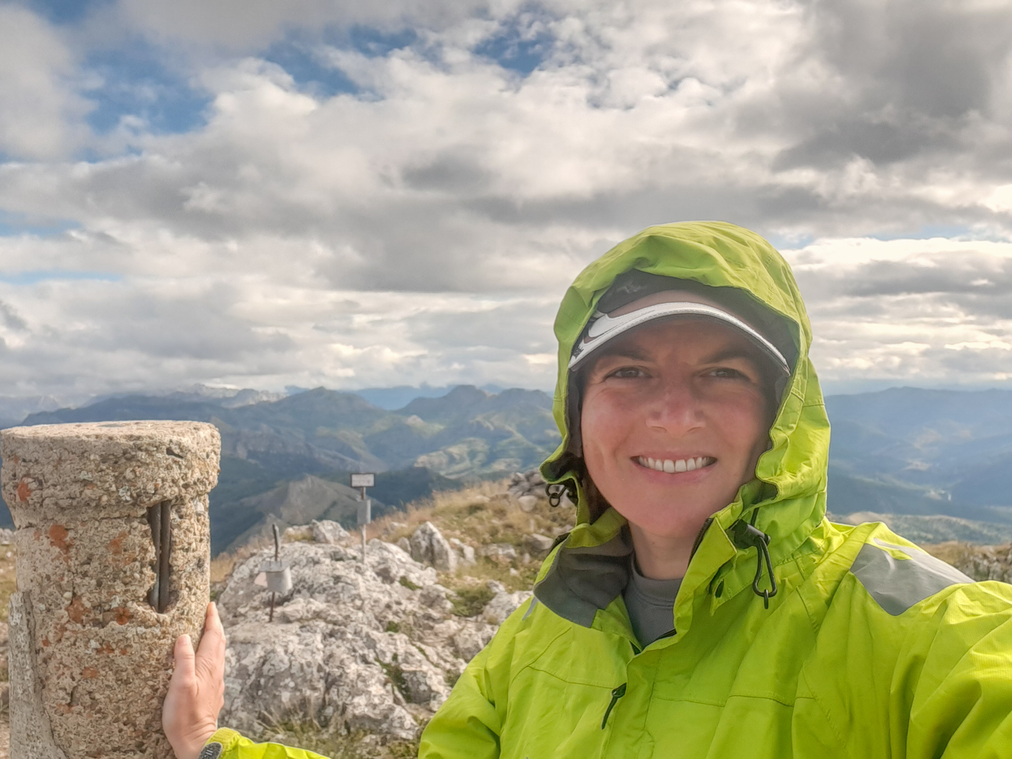
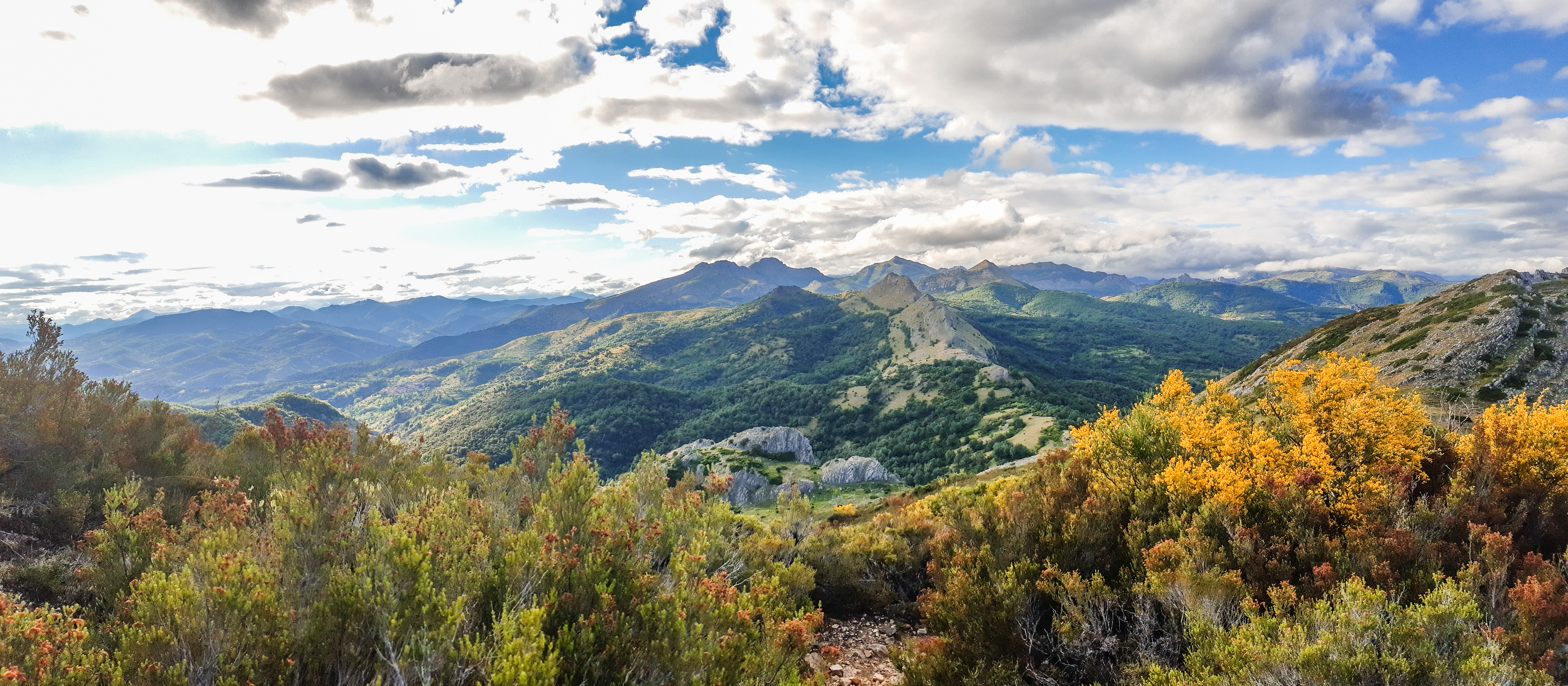
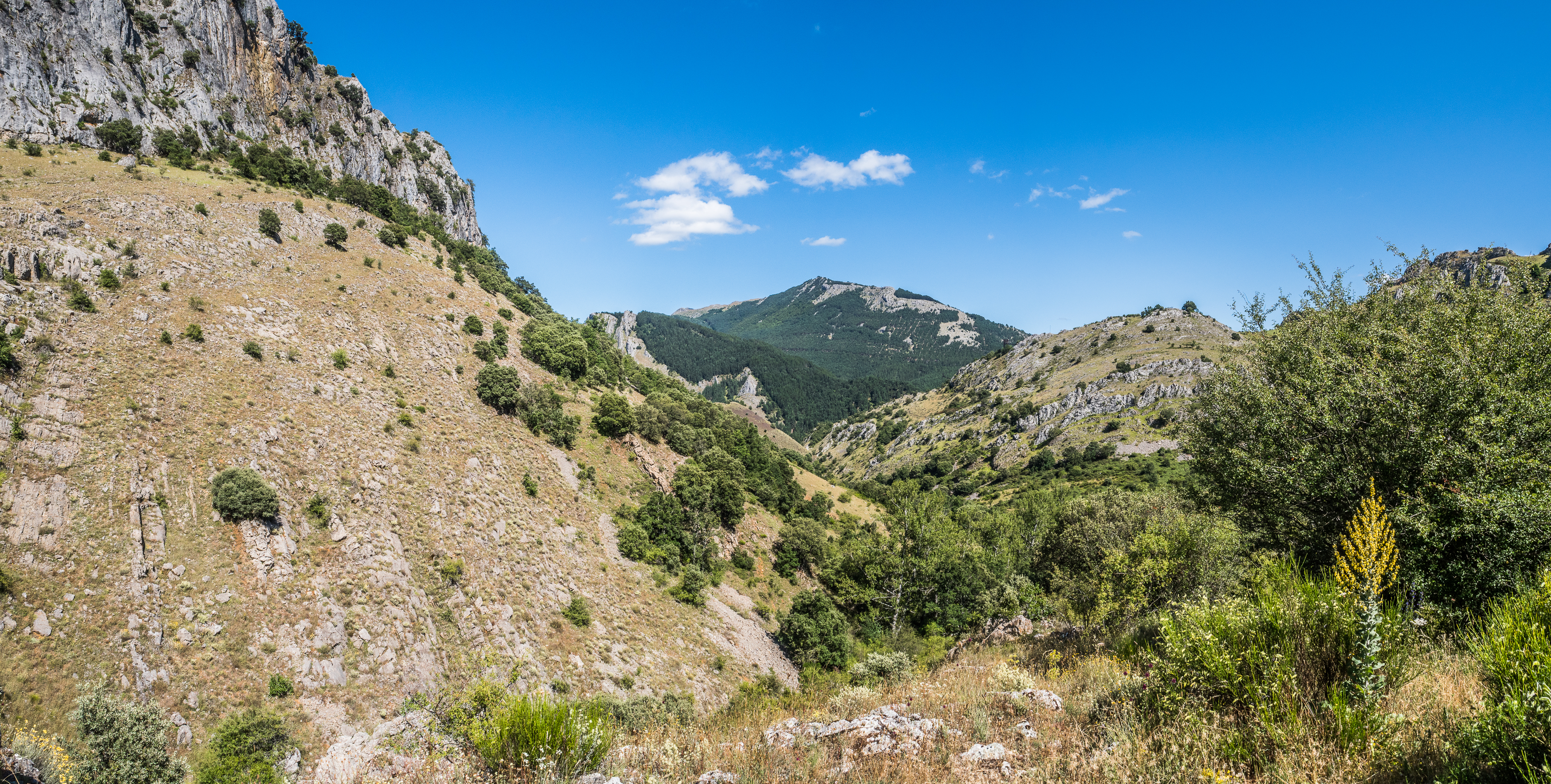
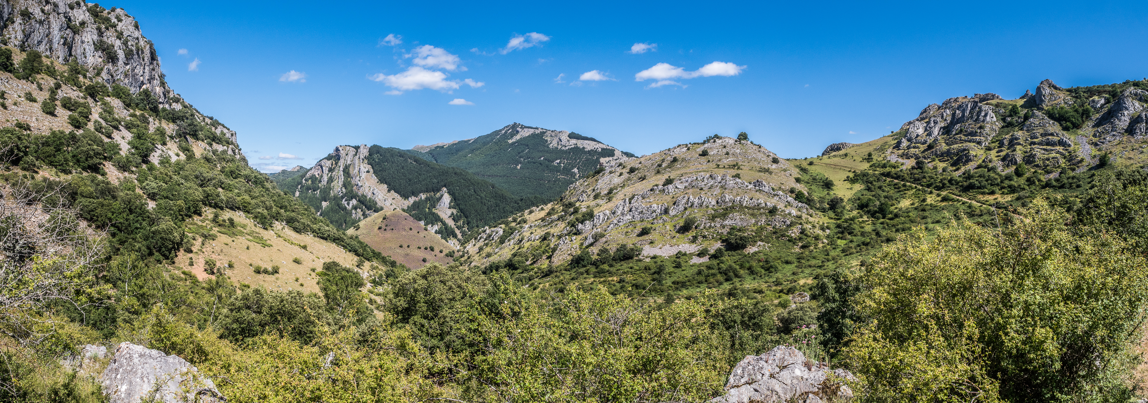
Congratulations, you are now standing on Peñacorada and can admire the views of the Cordillera Cantabrica and Picos de Europa in the distance. But the fun is not over. You still have to descend. You’ll see the dirt road deep down below you, you’ll just have to get to it without killing yourself. Don’t bother looking for a trail, there is none. You’ll have to negotiate your way down best you can through a slippery stone field. Keep in sight the direction and best of luck. It’s probably physically more demanding than the ascend. Once you get to the road, you will see a signpost to Santuario Virgen de la Velilla, 2 km away. If you started the hike at a reasonable hour and have daylight left, it’s worth the detour, only about half an hour of a mostly flat walk away (plus the time to return as you’ll have to come back the same way). The church is stunning and deserves a visit. Otherwise, cross the dirt road and take a smaller trail, that will take you on the other side of the valley, gently descending though an oak forest all the way back to Fuentes (which you will reach from above).


Starting point: village of Fuentes de Peñacorada
How to get there: the turn to Fuentes from the road N-621 between Cistierna and Sabero is clearly marked. The road that leads to the village has been recently repaved, but it is a winding, narrow, mostly one-track lane popular with cyclists, so try driving like a human being. There is absolutely nothing in in the village. No bar, no shop. According the census of 2012, there were 42 stable inhabitants, but I doubt it’s still the case. There is a church and some houses have been refurbished as seconds homes or tourist rentals, but mostly Fuentes de Peñacorada is a ghost town. There appears to be a bus stop, but I have no idea when or even if the bus goes. I left the car in the only place that didn’t look like someone’s garden (by the trash bins by the bus stop). It also happened to be the only place I could reverse from without risking driving into a wall or off a cliff, but that’s an entirely different matter.
Length and climb: cca 12.5 km / 750 m accumulated climb.
Difficulty: with a cold mind and knowing where to go, I’d probably define the hike as moderate, but at the time I found it bloody horrible. And every step hurt for the following two days. Not suitable for children, unless you want to really tire them and/or abandon them in the forest. I won’t judge you if you do. On the other hand, suitable for pets, if you happen to own a pet mountain goat.

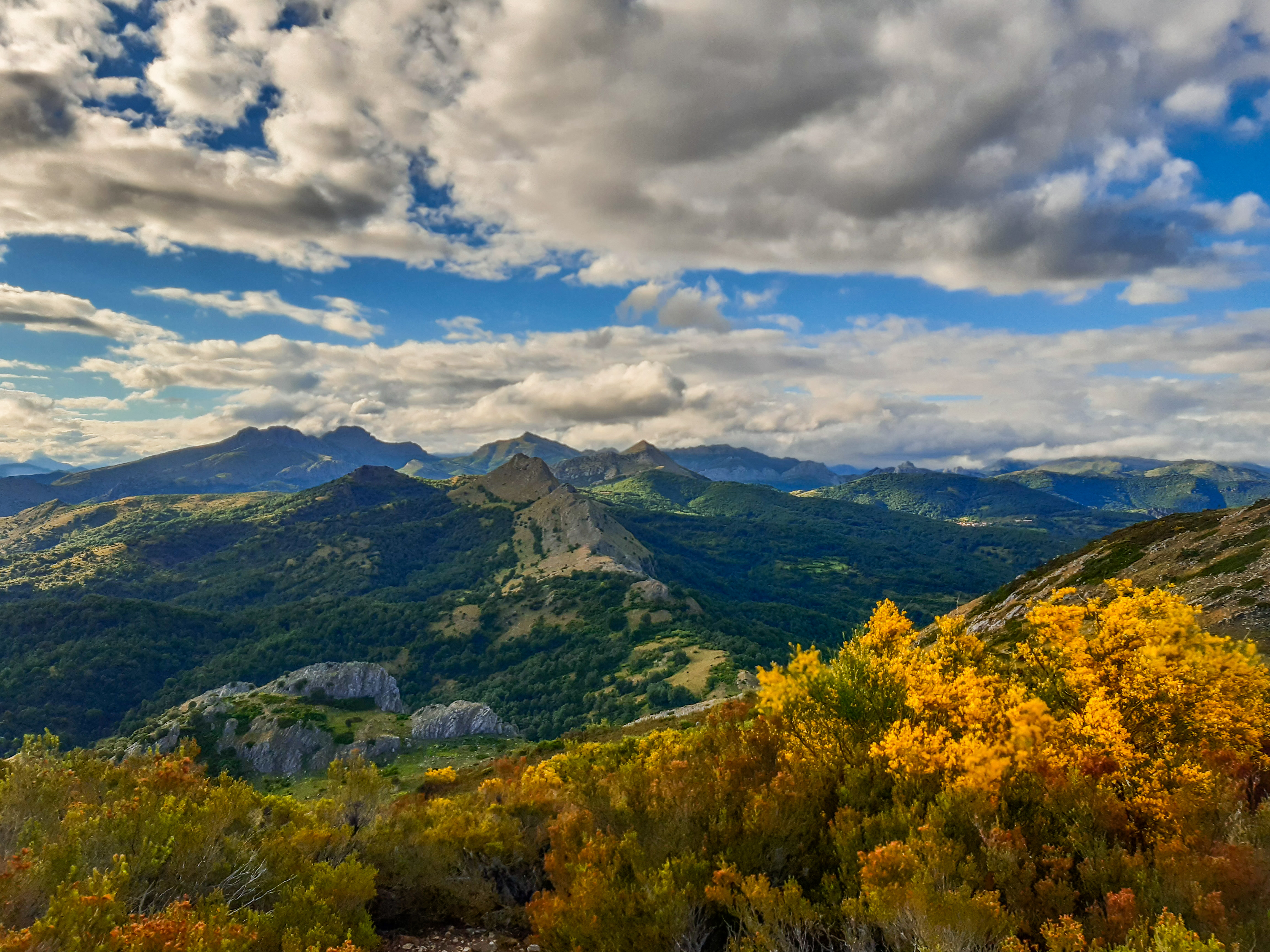
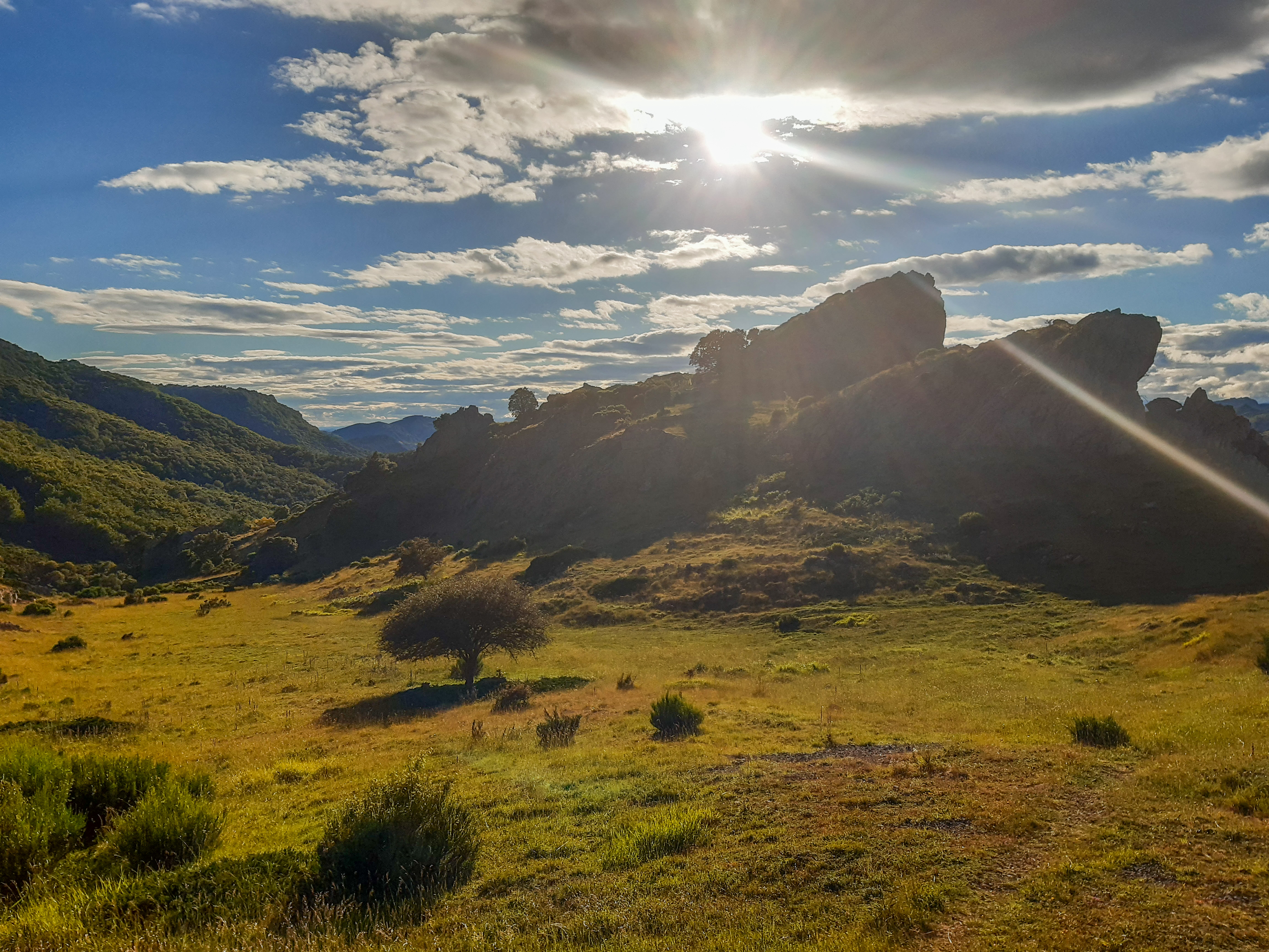
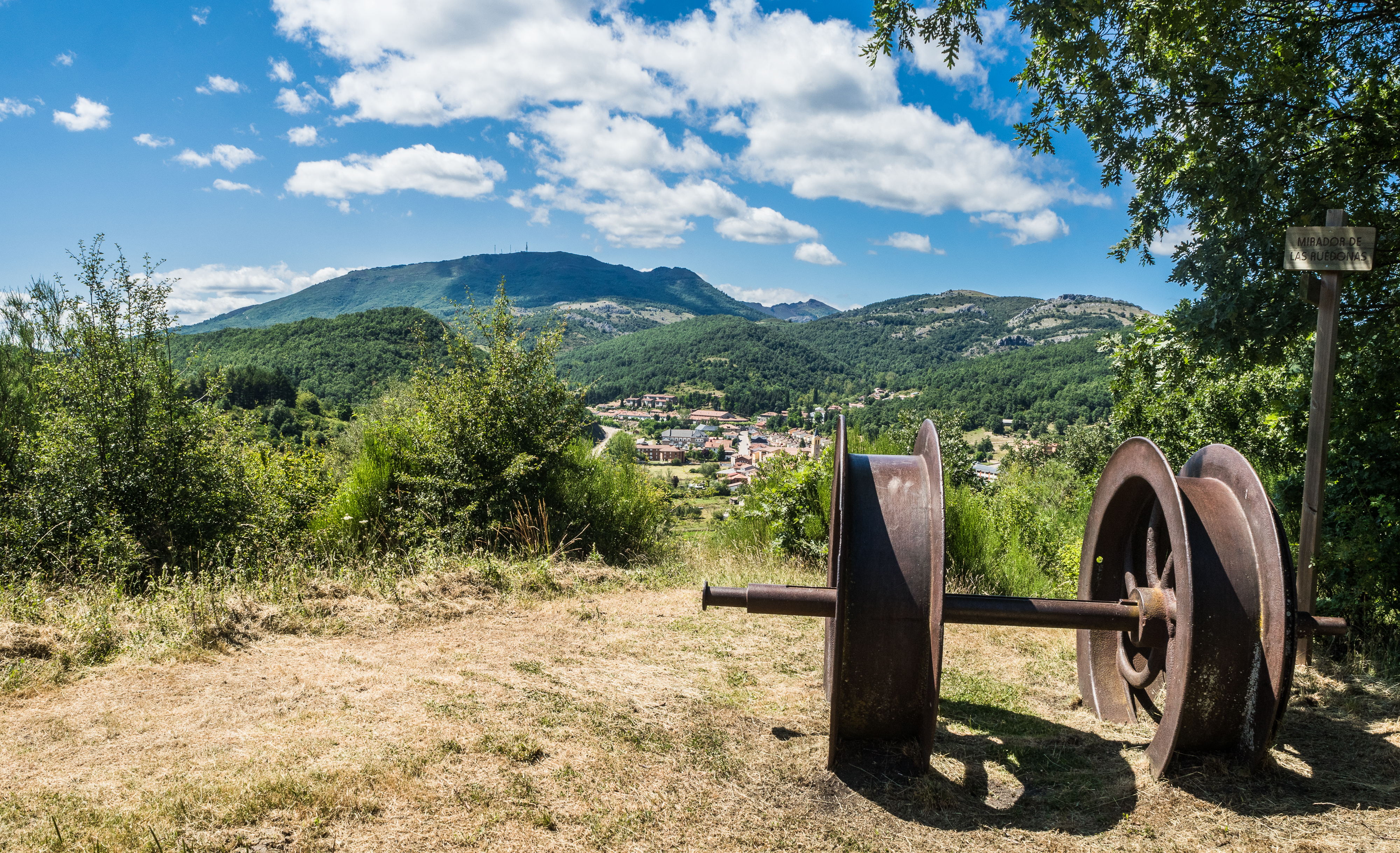
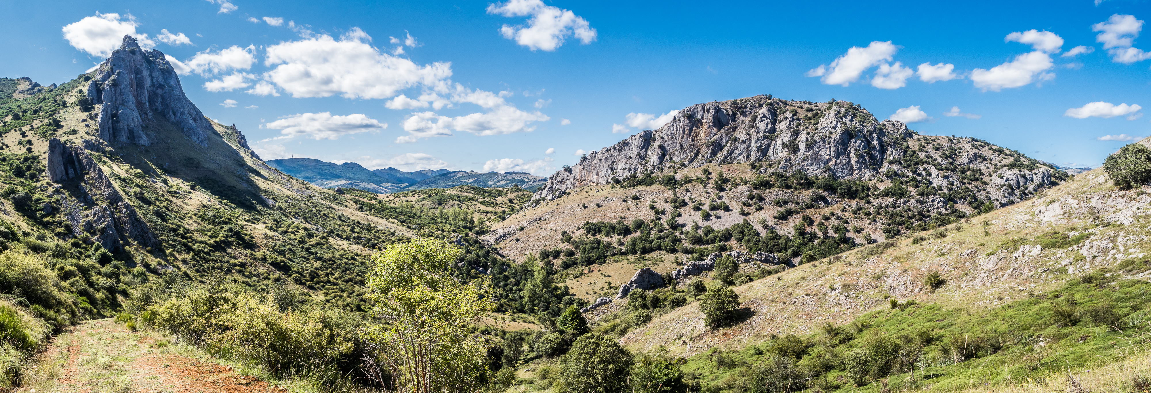
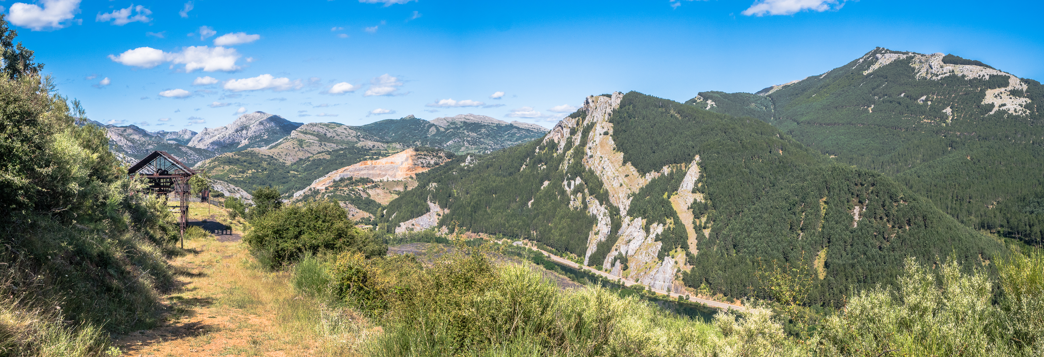
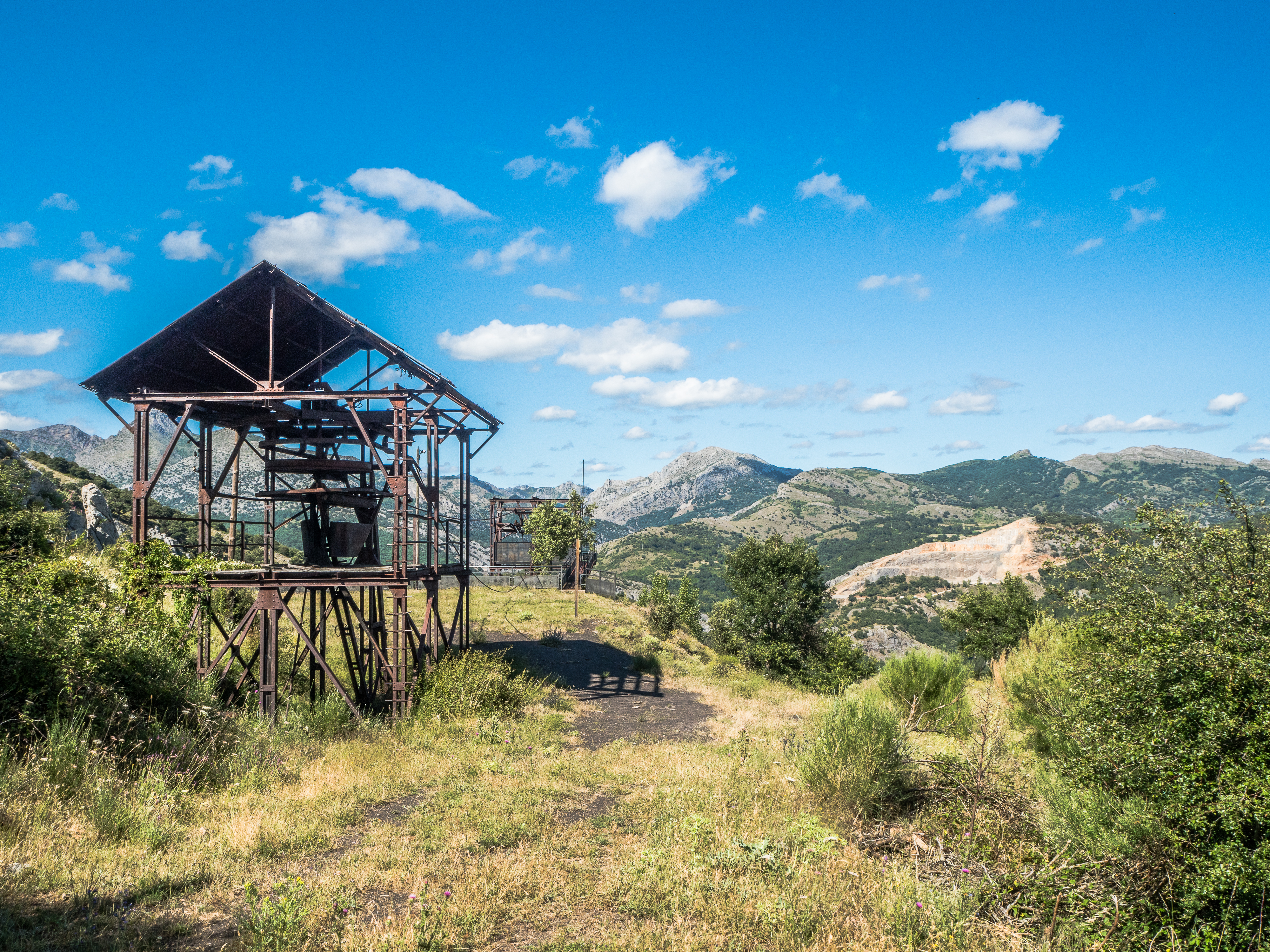
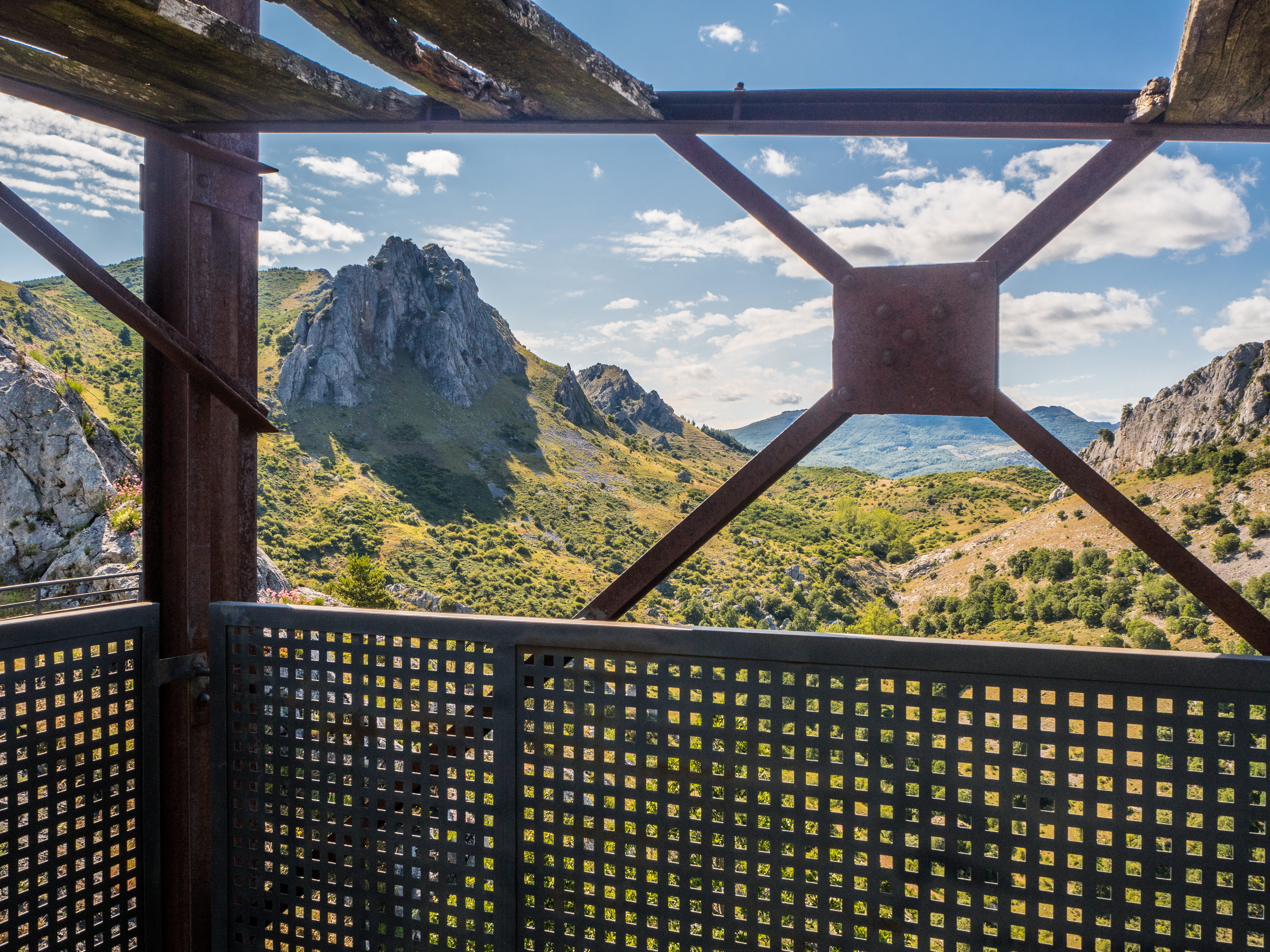
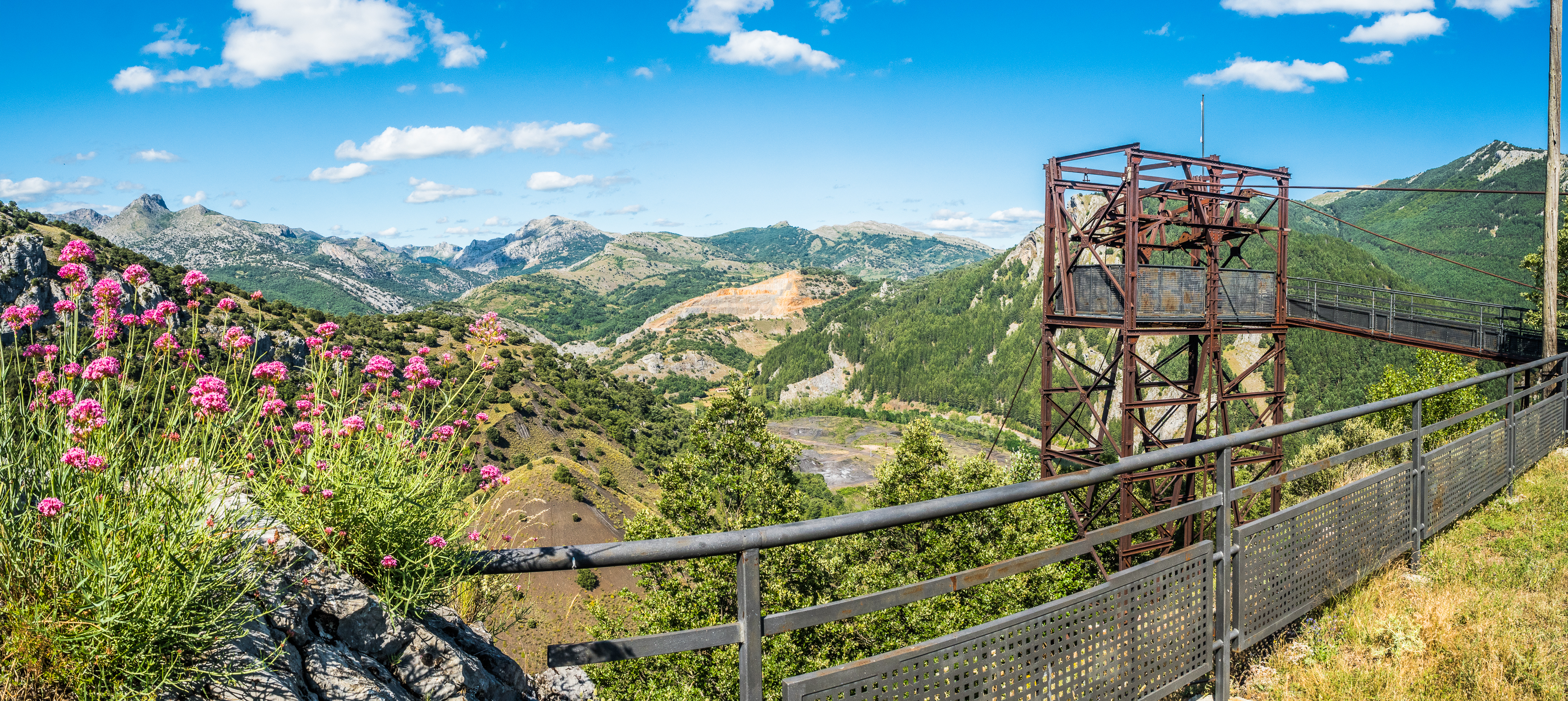
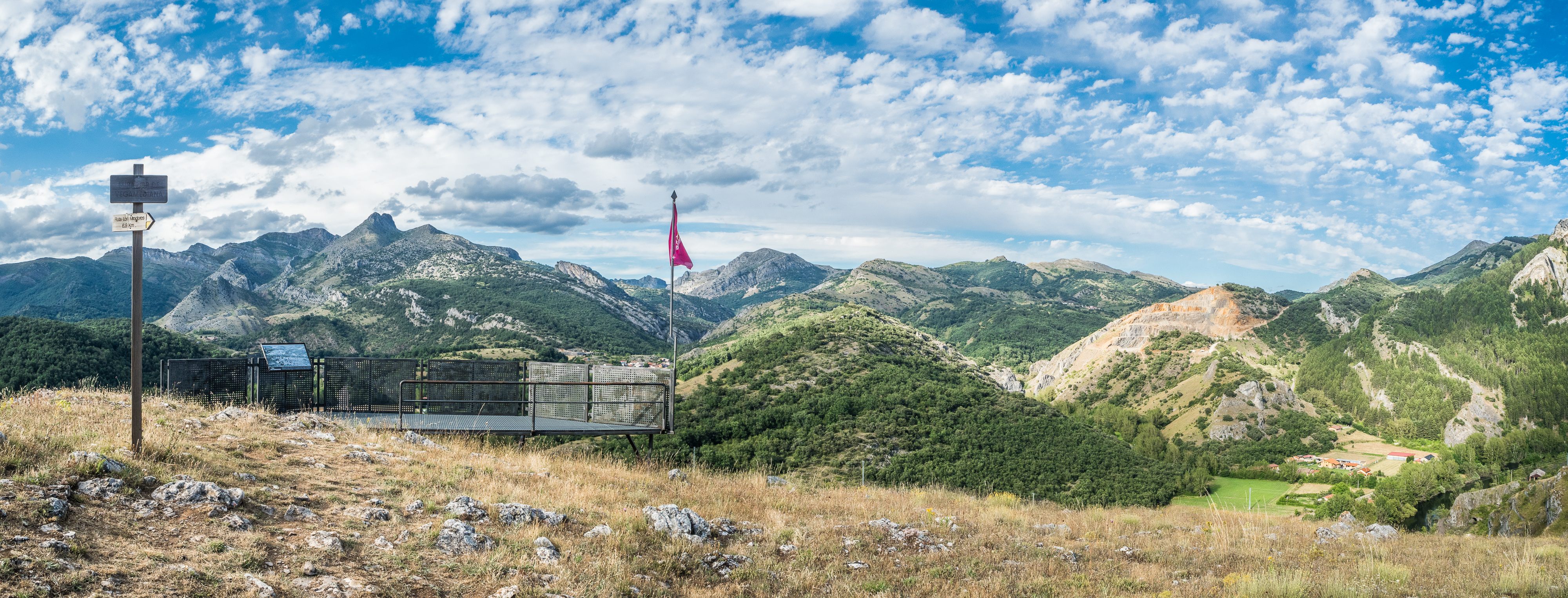
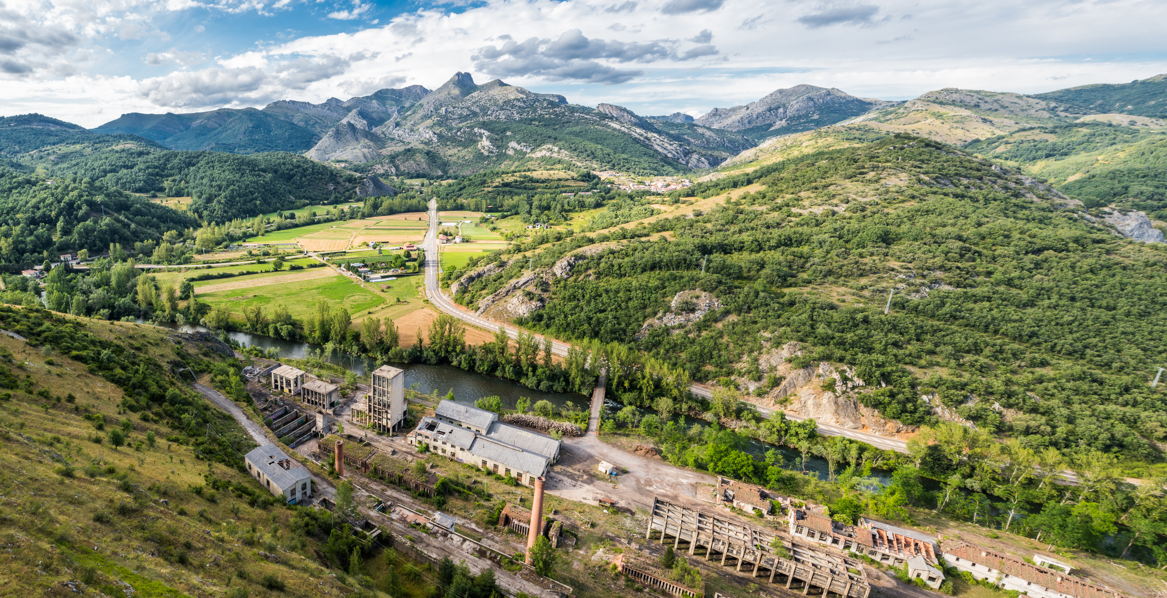
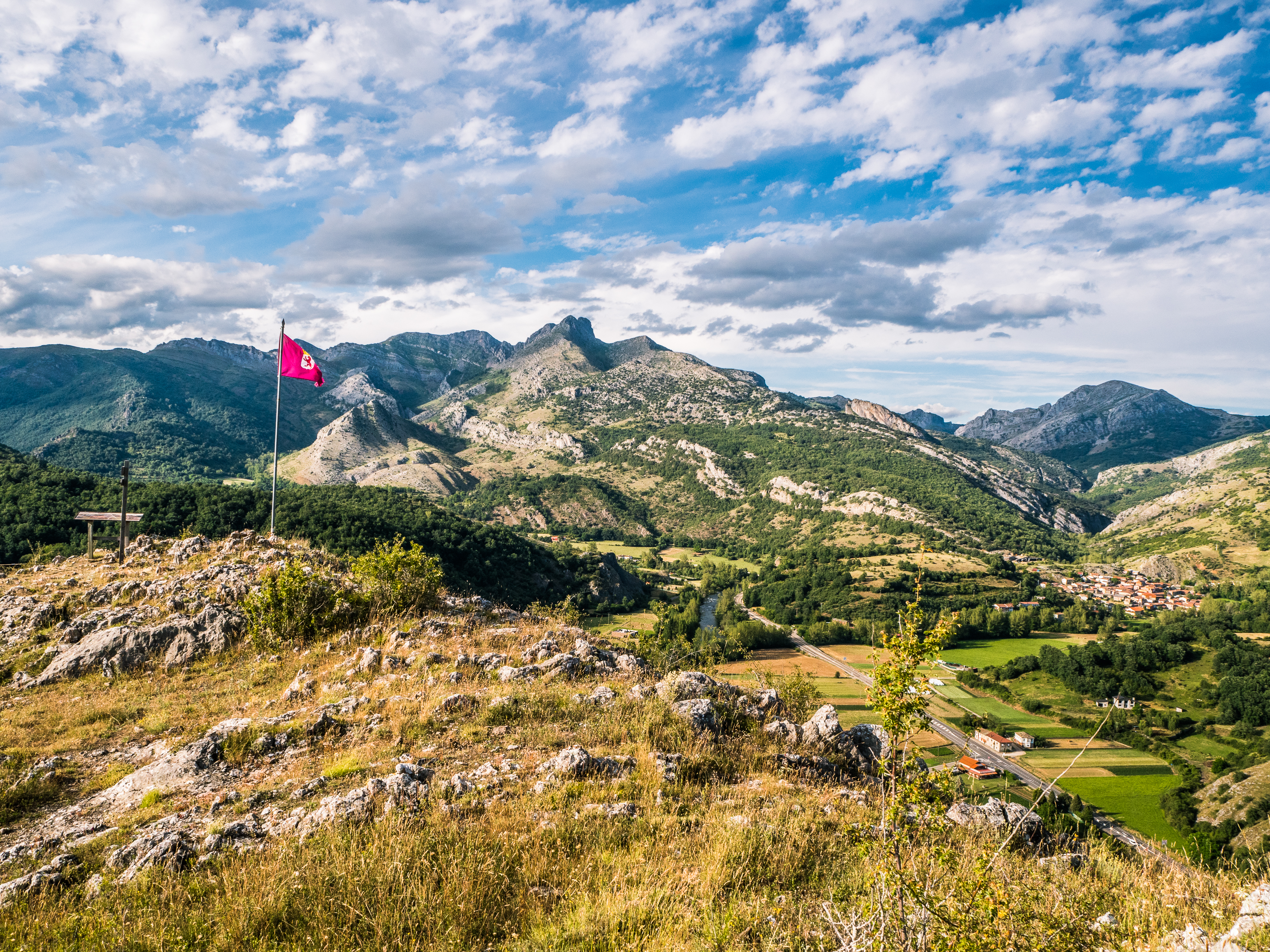
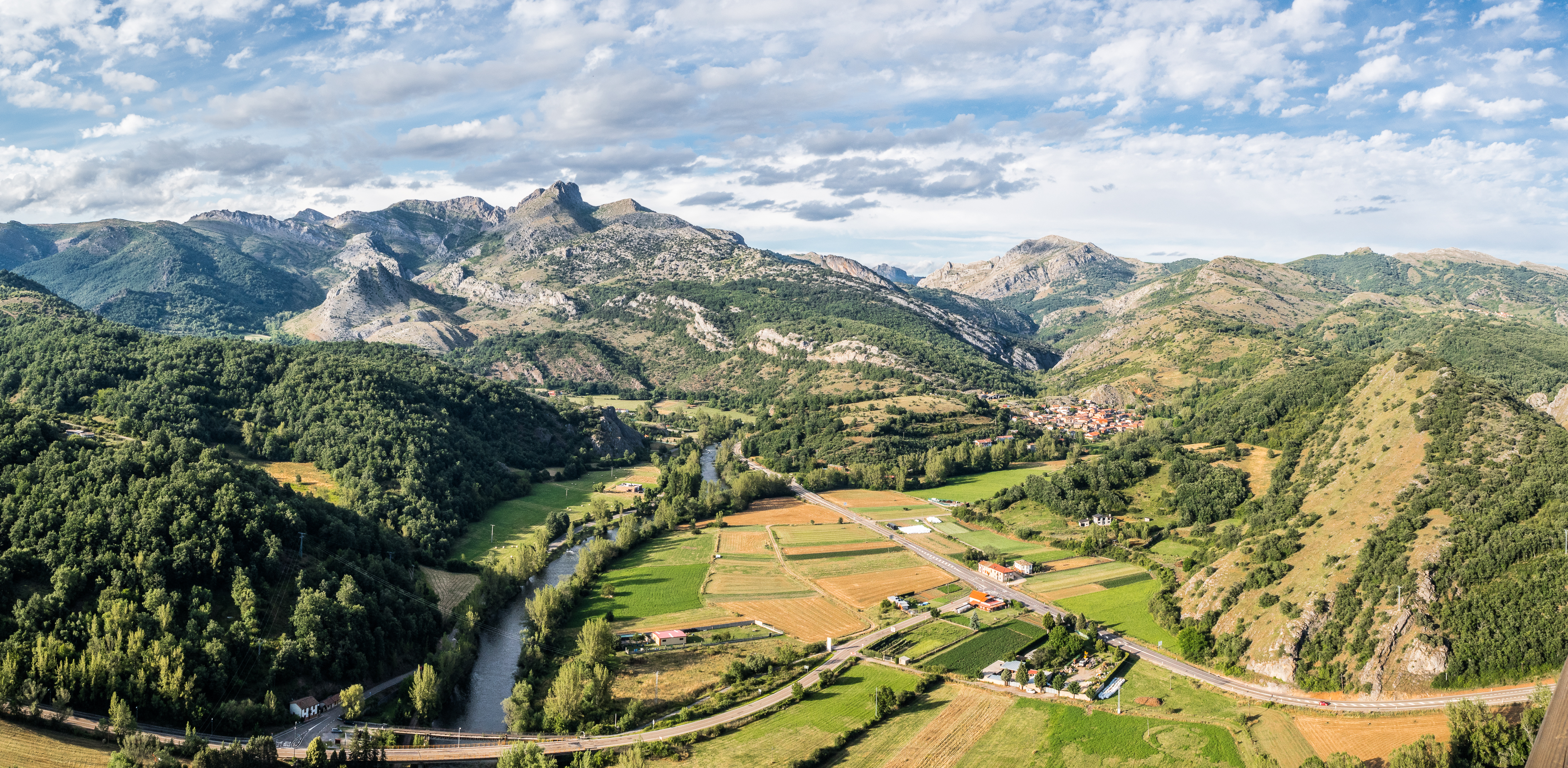
Ruta de los Miradores (Sabero): Sabero was a coal and iron mining centre since the first industrialisation of the Spanish north in the first half of the 19th century, reaching the peak of production in 1950s. The last mine closed in 1991. With the main source of employment gone, the town partly reinvented itself as a centre of tourism, sports and production of gourmet meats. The town hall created two educational trails that will guide walkers around mines from various periods around Sabero, La Ruta de las Minas (which I hiked last year) and La Ruta de los Miradores, presented here. It will take you on a loop around the viewpoints (miradores) of the area, from where you’ll be able to admire splendid views over the valley of river Esla, peaks of Cordillera Cantabrica, and around the ruins of 10th century castle Castillo de Aquilar (which you can ascend to, although very little is still visible). The trail is clearly marked and easy to follow, “easy” being the crucial part. “Clearly marked” was also a welcome feature. I opted for this particular walk to try to loosen my legs, given I still could not move properly (or descend stairs without moaning) after the Peñacorada adventure two days earlier. Most people would hike it clockwise, starting with the ascend to the Mirador del Castro. I chose the opposite direction because I wanted the sun to be low by the time I reached this particular viewpoint. It’s a loop, so it doesn’t really matter what you do.
Starting point: the official information leaflet pinpoints the start of the trail to the Museum of Siderurgy in Sabero, but the loop really starts at the crossing of Calle Bernardino García with the N-626 state road.
How to get there: park anywhere in Sabero.
Length and climb: roughly 7 km / 380 m accumulated climb
Difficulty: Easy. Suitable for children. Minimum fitness would be a plus as there are some steep, albeit short, ascends and descends, however there are also options to skip those and/or shorten the walk. Wikiloc for your convenience, note that I walked it counterclockwise. The only fountain can be found at the beginning of the trail.


See, I am able to write a rant free article. I promise I’ll try my best so that it doesn’t happen again. We would not want this blog to become boring after all. We would not want my readers to think that I have become a respectable young(ish) lady, either. Or that politics does not piss me off anymore. Quite the contrary, I just cannot decide which topic to tackle first. Stay tuned.

Wanted to comment on your previous post/rant. Got distracted, oh well. You write like an angel! A depraved one, but definitely an angel! Very nice photos too. You are my favourite imaginary girlfriend. I have no life. Imma staying tuned!
LikeLiked by 1 person