After 14 weeks of confinement and social restrictions, Madrid entered the new normality at the stroke of midnight last Sunday. Which basically means that getting a table in a bar doesn’t involve queueing for an hour while trying to outstare the luckier customers into surrendering their table quicker. Which is an improvement. It also means that we can now move between regions and all over the country freely (so the lone rides during forbidden hours lost the excitement of illegality) and that sports organisations, including my fencing club, tentatively reopened. With social distancing measures in place, which seems a bit illogical, as keeping the opponent at safe distance is kind of the point of fencing, but still.
I am proud (and slightly puzzled) to announce that my ageing body seemed to have profited from the quarantine (on the outside, I am quite certain my internal organs haven’t). I received compliments on losing weight (from people who definitely did not mean it as a compliment, but rather to point out that I needed to lose weight before), which I hadn’t noticed because I have been living (and loving it) in yoga pants and oversized T-shirts since March 14th. So I tried my fencing uniform (that is anything but elastic) and it feels loose. Curious. Last time I had visible abs, I was heavily flirting with an eating disorder. I was training for a triathlon, while surviving on one Itsu detox noodle soup a day (which had something like 150 calories, not that I was counting them, but it was the only thing that seemed capable of staying in my stomach). This time, the diet consisted of consuming elevated quantities of alcohol and binging on fried shit and pizza way past what is considered appropriate dinner time even in this country, upon return from my semi-legal long evening walks and rides with the 11 pm curfew. Et voilà, never had a better beach body. Not that I will be going to a beach this summer.

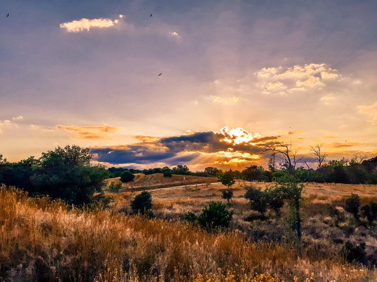
Since they opened the cages, I have been alternating long walks in Casa de Campo and solitary bike rides in proximity of the capital, while planning longer multiple days excursions, but that will now have to wait for more clement weather. As soon as getting out of the region became legal, temperatures rocketed to high 30s, obviously, so engaging in any outdoor physical activity more demanding that lifting a glass of iced tinto de verano is out of question. But stay tuned. I bought some ridiculously expensive bike bags and a tent, and have a couple of ideas in mind (which I will most likely regret as soon as I set off) that will constitute some excellent writing material.
In the meanwhile, the only place reachable by public transport that offers some solace from the Madrid inferno is the nearby Sierra de Guadarrama. A couple of ideas for potential hikers among my readers:
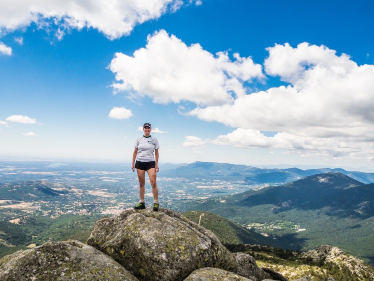
Day hike option 1: Cercedilla – Valle de la Fuenfría – Puerto de la Fuenfría – Pradera de Navarrulaque – Mirador de los Poetas – Cercedilla
Difficulty: medium-low
Length: 21 km; Accumulated climb: +580 m / -580 m
Description: Leave the station of Cercedilla on the left back of the valley following Camino Puricelli (marked dark blue) to Las Dehesas (if you are driving to Cercedilla and arrive early enough, you can park here). Then follow the tarmac road for a few hundred metres, and enter the national park over the Puente del Descalzo, following Calzada Borbonica (marked white) up the Fuenfría Valley (this path coincides with Camino de Santiago, therefore is also marked with the characteristic shell signs). You will arrive to the pass Puerto de la Fuenfría (1793 m) after maybe an hour and a half. This is the highest point of the route. From here you slowly start returning to Cercedilla, along the very flat and comfortable Carretera de la República. You will encounter a fountain (Fuente de Anton Ruiz) after about 15 minutes, where you can refill your water bottles. It is marked as untreated, but it’s perfectly fine. I drank the water every time I hiked in Cercedilla and nothing ever happened. You’ll arrive to a beautiful meadow Pradera de Navarrulaque in about 40 minutes and to Mirador de los Poetas in another 15, either makes a good spot for a break/lunch/snack. From the viewpoint take the yellow-marked path to descend into the valley (the first part is quite steep, so take extra care) until it crosses with Camino del Aqua (marked pale blue), turn left at the crossing, and you will arrive back to the village in another approximately 40 minutes.
Equipment: none needed, apart from decent shoes. Take a lot of water.


Day hike option 2: Cercedilla – Camino Schmidt – Collado Ventoso – Pico 2 – Senda de los Alevines – Pico de Majalasna – Pradera de Navarrulaque – Mirador de los Poetas – Cercedilla
Difficulty: medium (although there is a part of Senda de los Alevines where you will need to go down on all fours)
Length: 25 km (maybe a little more); Accumulated climb: +880 m / -880 m
Description: you will follow the same path as in the option 1, all the way to Pradera de lor Corralillos, where the Calzada Borbonica (white) and Camino Schmidt (yellow) divide. Keep on Camino Schmidt, and you will cross Carretera de la República at Fuente de Anton Ruiz and continue climbing from there for another 15 minutes to Collado Ventoso. From here it’s another 30-40 minutes climb to the Pico 2 (2094 m, the highest point of the hike ans the second peak of the Siete Picos range). We had lunch at the top, and considered what next. Taking the high path that takes you to the summits of all the other peaks and eventually to Puerto de Navacerrada, which would have been a nicer, more scenic trail, but it would also mean no shade in the hottest hours of the day, so we decided to leave it for autumn. Therefore we descended back to Collado Ventoso and took the Senda de los Alevines (marked also yellow, like Camino Schmidt) around the mountain to Pradera de Majalasna. This is the only part of the hike that is a little bit physically demanding, as you will need to use your hands on a several occasions. From the Pradera (meadow) you can ascend to Majalasna peak (1933 m), it will take you about 5 minutes, then continue on the yellow path to Pradera de Navarrulaque and the remaining part of the trek is identical to the one described in option 1.
Equipment: none needed. Decent shoes, obviously, and walking sticks if you are used to them.


The only problem with Cercedilla, especially if you arrive with public transport, is that the initial and final parts are long (if flat) and rather boring. It takes forever before you start picking up some altitude, and after you descend back to the valley, you still have a good hour of walking before you can have a well-earned drink. Which of course is the only reason anyone goes hiking. I will look into this and plan the starting point of the next trips from a Navacerrada or Cotos, which too can be reached by public transport and offer more rewarding hikes. For your convenience, the hiking map of the area is available here.
